15 R HARVEST CIR
Owner Information
ASHLEY HERBERT W TRUSTEE
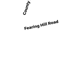
142 FEARING HILL RD
W WAREHAM, MA 02576


Property Details
15 R HARVEST CIR is classified as a Undevelopable Residential Land (Vacant land).
15 R HARVEST CIR is valued at $33,800. The land is valued at $33,800 and the structures are valued at $0.
This property is in Zone R60. Confirm with local Zoning Board authorities to ensure there are no overlays or other easements on this property.
The most recent deed for 15 R HARVEST CIR is recorded at the local registrar in Book 24466, Page 0254. 15 R HARVEST CIR was last sold on Thursday, March 13, 2003 for $180,000.
Assessment data from fiscal year 2022.
Flood Data
According to the FEMA National Flood Hazard Layer, this property does not appear to be in a flood zone. It may also be in an area not yet reviewed. Nonetheless, confirm this information prior to taking any action.
To view the flood hazards around this property, create a FEMA "Firmette" Map of the area around 15 R HARVEST CIR.
Broadband Internet Providers
| Provider | Type | Bandwidth (mbps) | |
|---|---|---|---|
| Viasat Inc | Satellite | 35 | 3 |
| Verizon New England Inc. | Fiber | 940 | 880 |
| Comcast | Cable | 1000 | 35 |
| GCI Communication Corp. | Satellite | 0 | 0 |
| HughesNet | Satellite | 25 | 3 |
| VSAT Systems, LLC. | Satellite | 2 | 1 |
| Verizon New England Inc. | DSL | 5 | 0 |
Broadband service provider data from December 2020.
Adjacent Properties
- 15 HARVEST CIR
Developable Residential Land owned by ASHLEY HERBERT W TRUSTEE - 19 HARVEST CIR
Single Family Residential owned by COHN PETER C - 13 HARVEST CIR
Single Family Residential owned by SANFORD JONATHAN - 150 FEARING HILL RD
Single Family Residential owned by TUOMALA PAUL WILLIAM - 142 FEARING HILL RD
Mixed Use (Primarily Residential, some Commercial) owned by ASHLEY HERBERT W TRUSTEE - 142 FEARING HILL RD
Mixed Use (Primarily Agriculture) owned by ASHLEY HERBERT W TRUSTEE